Post-doc Researcher in Focus
Dr Tom Fitton tells us about his research
Tom is a landscape archaeologist specialising in geophysical survey, remote sensing, and GIS analysis, with a particular interest in the maritime landscapes of the Swahili Coast of Eastern Africa and the western Indian Ocean.
Tom studied Archaeology at the University of Southampton (2004-2007; BA) and Near Eastern landscape archaeology at Durham University under Professor Tony Wilkinson (2008-2009; MA), with an emphasis on the early Islamic ports of the Persian Gulf. Following this he worked as a self-employed archaeological GIS specialist and geophysicist in the UK, France, and Kuwait. Among other projects he was commissioned to create a series of CGI landscape models representing key archaeological phases of the Sacred Garden at Lumbini, Nepal, based on Durham University/UNESCO excavations of the protected WHO site, which were used in the National Geographic documentary 'Buried Secrets of The Buddha' [https://www.natgeotv.com/int/buried-secrets-of-the-buddha] and 3D printed by Tom for the ‘Walking with the Buddha’ [https://www.dur.ac.uk/research/themes/news/?itemno=36054] collaborative exhibition between Durham University and the Fo Guang Shan Buddha Museum in Taiwan in 2018, before being installed as part of a permanent exhibition in the refurbished museum at Tilaurakot, Nepal.
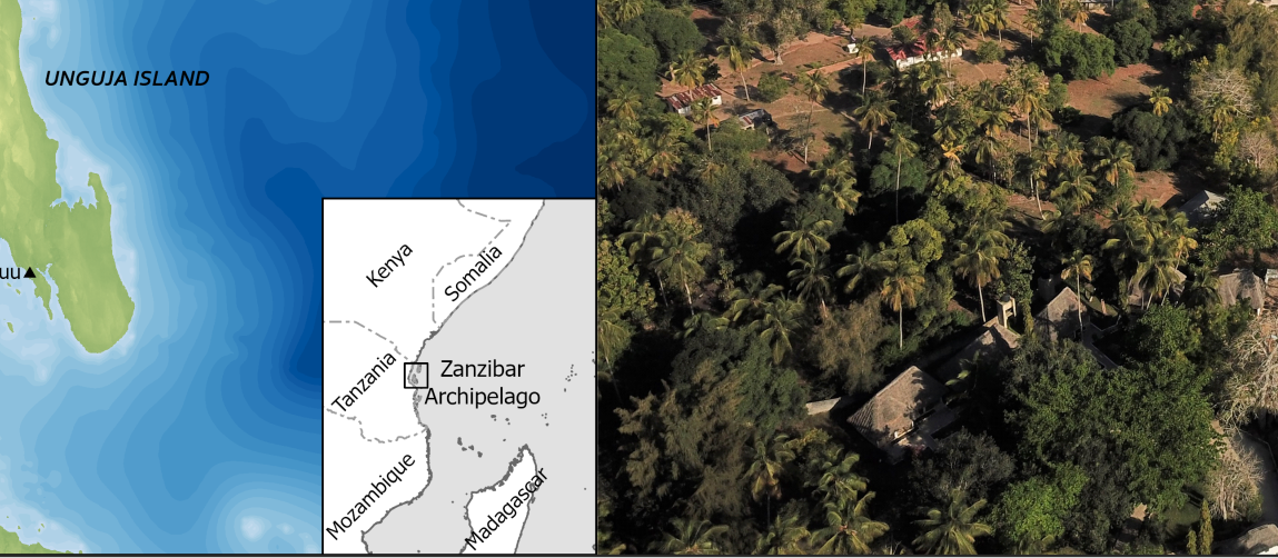
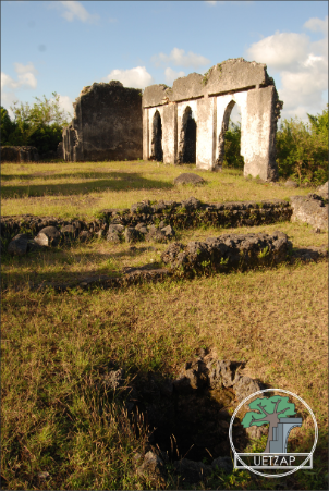
In April 2019 he was appointed as a PDRA on the Leverhulme-funded Urban Ecology and Transitions in the Zanzibar Archipelago Project (UETZAP)[ https://urbanecologyzanzibar.wordpress.com/], led by Dr Stephanie Wynne-Jones [https://www.york.ac.uk/archaeology/people/academic-staff/wynne-jones/], Dr Michelle Alexander [https://www.york.ac.uk/archaeology/people/academic-staff/alexander/], and Dr Federica Sulas (University of Cambridge)[ https://www.arch.cam.ac.uk/staff/dr-federica-sulas]. The project is an exploration of the ways that early urban centres on Zanzibar drew on, utilised, and affected their resource landscapes during two major periods of urban growth. Fieldwork at Unguja Ukuu (7th – 15th centuries) and Tumbatu (11th – 15th centuries) on Zanzibar is concentrating on domestic contexts to analyse the ways that local resources were used and built into the spaces of the towns, and the result will be a clearer understanding of the relationship between these urban centres and their surrounding resource landscapes.Tom came to York in 2011 and spent two years as the Archaeology Department's Computing Officer, before starting an AHRC-funded White Rose Doctoral Studentship in 2014. His PhD thesis ‘Pushing the Boat Out’ [http://etheses.whiterose.ac.uk/19224/] (2014-2017; supervised by Dr Stephanie Wynne-Jones) involved a geophysical and GIS investigation of the early Swahili harbours of the Zanzibar Archipelago, and demonstrated a pattern of spatial layouts and maritime activity that indicate the knowledgeable maritime exploitation of coastal environments by the Swahili settlers of the archipelago. On completion of his thesis Tom worked part-time as a post-doctoral remote sensing specialist for the ‘Persia and its Neighbours’ Project [https://www.dur.ac.uk/research/directory/view/?mode=project&id=704] and EAMENA [https://eamena.org/] at Durham University. After receiving a Vice-Chancellors Teaching Award from the University of York in 2016 he was appointed an Associate Lecturer in Archaeology in 2017 to act as sabbatical Course Director of the MA Historical Archaeology [https://www.york.ac.uk/study/postgraduate-taught/courses/ma-historical-archaeology/], focusing on the archaeology of the African diaspora, European colonisation of the Americas, and globalisation; and leading the first-year History and Theory of Archaeology module [https://www.york.ac.uk/students/studying/manage/programmes/module-catalogue/module/ARC00005C/2018-19].
 resized.jpg)
Tom’s role on UETZAP is the creation and analysis of a project-wide GIS combining primary survey and excavation data from project fieldwork, with satellite and remote sensing imagery, historical sources, and legacy data to investigate the relationship between the archaeological settlements and their contemporary landscape environments. He is currently mapping the changing spatial plan of Unguja Ukuu and its potential resources hinterlands; and exploring the potential for mapping paleolandscapes on Zanzibar’s tropical coast using ground-truthed satellite imagery and aerial surveys. As well as co-directing project fieldwork with Dr Wynne-Jones, Tom recently supervised a collaboration with the State University of Zanzibar to carry out a remote participatory GIS survey of modern landscape use at Unguja Ukuu.