Department of Archaeology
HEEAL: Historical Ecologies of East African Landscapes
Sub-projects
Landscape histories, perceptions and policies in East Africa
Pauline von Hellermann
This HEEAL sub-project complements the archaeological research in a number of ways. Collating travel reports, colonial and missionary archival sources and historical landscape photographs, Pauline is setting up a comprehensive dataset of historical landscape change in Northeastern Tanzania, which will eventually bring together data from all of HEEAL’s sub-projects. Secondly, she is using historical photographs as the starting point for ethnographic research into landscape memory, exploring how and why different groups may perceive landscape change differently. Thirdly, she will link HEEAL’s historical and archaeological insights to current policy concerns, and explore their implications for existing development and conservation initiatives in Northeastern Tanzania.
Environmental & social consequences of the intensification of agriculture
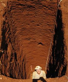
Daryl Stump
The history of landscape management in east Africa is often cited in support of policies or developmental interventions which aim to promote economic or environmental sustainability, yet in many instances this history is poorly understood. Local practices have consequently been presented as destructive (for example as causing soil degradation or deforestation) or as environmentally appropriate (on the grounds of the assumed longevity of local strategies of resource use), with many such narratives citing the expansion of the slave and ivory trades in the 18th and 19th centuries and the subsequent period of colonial rule as turning points in the histories of these areas. Using a combination of documentary and oral historical sources, archaeological survey, remote sensing and stratigraphic investigations of landscape features, this HEEAL sub-project aims to examine the veracity of such narratives in relation to the intensive agricultural communities in the Pare highlands of northern Tanzania. Focussing primarily on the North Pare Mountains, fieldwork has been attempting to map the development of the terrace and irrigation systems in this area and to relate this development to broader environmental, climatic and economic changes. In doing so the intention is to test deforestation and soil degradation hypotheses in the light of North Pare's reputation in the 19th century as a centre for the production of iron, pottery and agricultural goods.
Tracing the links between elephants, humans, and land use in East Africa during the 19th century caravan trade: a bioarchaeological study
Ashley Coutu
This project will trace links between elephants, humans and land-use before, during and after the 19th-century caravan trade using a variety of sources including stable isotope analysis of ivory sourced from East African archaeological deposits, museum collections and from archaeological investigations of ivory processing sites in the UK and USA. Stable isotope analysis will enable examinations of elephant diet and migration patterns, and the sourcing of ivory to specific locations. When combined with historical records of ivory exports and ethnohistorical data relating to East African elephant hunters and ivory traders it is envisioned that this research will permit assessments of the numbers of elephants removed from the ecosystem and an appraisal of the ecological and economic consequences of this removal.
An historical archaeology of the 19th century caravan trade in East Africa: people, trade and diet
Thomas John
The expansion of the caravan trade from the late 18th century has been seen as a primary factor in the development of intensive agriculture in areas crossed by trade routes, with markets developing in these areas acting as points of interaction between farmers, pastoralists, traders and craft specialists. Using a combination of historical sources and detailed analysis of archaeological faunal and botanical assemblages from sites linked with caravan routes, this project aims to examine how the ecology of settlement areas were affected by this expansion of trade and whether changing economic strategies and relationships had any impacts on diets and levels of nutrition.
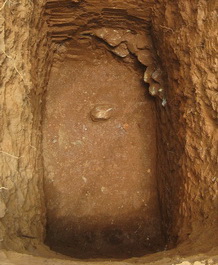
A history of soil erosion and past human land use in the North Pare Mountains, NE Tanzania.
Matthias Heckmann
Past soil erosion is recorded in correlated colluvial hill slope sediments throughout of the Pare region. These deposits are a key to understanding past human land use and landscape change as they are directly linked to slope processes possibly altered by human activities. Slope deposits of several Pare upland catchments have been investigated and - together with the palaeoecological evidence from swamp cores - allow the reconstruction of soil erosion phases and regional landscape change in the Pare Mountains during the last two millennia. Distinct soil erosion commences in North Pare during the middle of the first millennium AD and is likely to be related to the onset of agricultural land use, iron smelting and the associated woodland clearances in this part of Eastern Africa. Soil features like sand lenses, clay coatings, and re-deposited soil aggregates are used to infer changes in land use and land use intensity. The study shows how soil erosion histories can be used in archaeological contexts to understand when and how early human land use started to shape the Pare landscape and to assess when ecosystem thresholds were crossed leading to land degradation.
Related projects
- KITE York Institute for Tropical Ecosystem Dynamic
- CELP York Centre for Ecology, Law and Policy
- SEALINKS Bridging Continents Across the Sea: Multi-disciplinary perspectives on the prehistoric emergence of long-distance maritime contacts
- PLATINA - People Land and Time in Africa
Key documents