Researching and telling the history and archaeology of Walmgate Stray, York
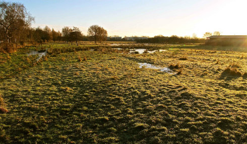
Walmgate Stray is an expanse of common pasture immediately beyond the University’s perimeter, a green open space between campus and city centre. It is owned and managed by City of York Council. Crossed by footpaths and cycle tracks, partly occupied by allotments, and fringed by a barracks, a hospital and residential areas, the Stray is shared by many people and used for a wide range of activities, from picnicking, dog-walking and sport to commuting, army training and livestock grazing. Most people appreciate the common's wildlife value, but few are aware of its historic importance. The Common Ground project is seeking to change this imbalance by researching the landscape's history and archaeology and telling the emerging story. The team is drawn from different parts of the local community.

Background
The history of Walmgate Stray
Today’s common is made up of two once-separate areas, which still have obviously different characters.
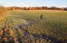
To the south, Low Moor is flat, boggy land, which became common pasture because it was no use for settlement or arable agriculture. We want to know how long it has been common - “since time immemorial”, according to the earliest documentary references in the mid-13th century. By then, each Freeman in Walmgate Ward (one of York's four ancient districts), was entitled to use the land as summer pasture for two horses or cows. To ensure their rights were not forgotten or compromised, each year the Lord Mayor of York would 'ride the bounds' of all the commons.
To the north, on the adjacent natural ridge, a block of former arable land was added to the ancient Stray in 1828 to compensate the Freemen for losses they had suffered through suburban development. Some of this land had long been under pasture, as shown by the preservation of medieval arable strip fields, which are still visible as broad, low ridges. It was on this land, in 1917, that Low Moor Allotments was established by popular demand.
Previous archaeological research
Mapping by English Heritage in 2004 showed that both parts of the common preserve archaeological 'earthworks' – artificial humps and bumps visible to the naked eye. These remains, which include traces of ploughing, quarries, ponds and military training features, are not rare. But the research also hinted that on the ridge - whose crest has probably always offered a convenient route and whose well-drained slopes are suitable for agriculture and settlement - more important remains might survive beneath the surface. Early remains were thought to include Green Dykes, an Iron Age boundary earthwork; Lamel Hill, a possible Roman burial mound later adapted to support a windmill; and an Anglo-Saxon burial ground (which, when partly excavated in 1983, was thought to have been used for dumping executed bodies).
Project aims
Common Ground's aims
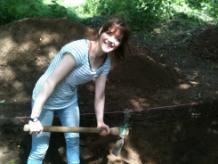
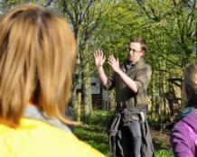
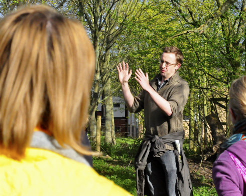
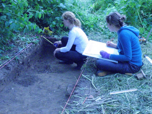
By surveying large areas and excavating a range of archaeological features, we hope to answer questions about the use of the common and its environs before 1066. In the process, we are training the participating students and local volunteers. We want to strengthen bonds within the University's research community and between the University and other groups, including archaeologists and local residents. Here are some comments we have received from people who have participated in the project so far:
I just wanted to mention how much I enjoyed the Common Ground excavation! I had a really constructive experience; I learned a lot and really felt valued as a member of the team. I also appreciated the way that the dig was coordinated - having student supervisors and there being the opportunity for volunteers to get more involved with the interpretative side, rather than simply being labourers. It all made for a really positive and enjoyable experience.
Alexandra (local volunteer)
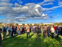
The guided walk around Walmgate Stray was really splendid - lots to think about.
John Oxley (Archaeologist for the City of York)
Thank you so much for coming to talk to our residents - they have been looking out of our windows and watching you all at work with great interest and curiosity over the past few weeks. We all found your talk absolutely fascinating - especially finding out that it's all there literally under our feet!
Kerry (Warden, Dower Court Flats)

Recent activities

Archaeological investigations in 2013
We investigated:
- the origins of the arable fields (and by inference the common pasture)
- the extent and character of the Roman and Anglo-Saxon burial ground
- the origins of Lamel Hill, believed to have been a Roman burial monument around which the Anglo-Saxon burial ground developed
- two suggested Roman roads
- Green Dykes, a lost Iron Age boundary earthwork.
- the character of Roman and prehistoric land-use on the ridge.
York's 'Roman Road 1'
Fulford Golf Club allowed us to excavate a trench across the suggested course of Road 1. Beneath decaying golf balls and early-20th century dumping, we found a single clay pipe stem - no, the Romans did not smoke tobacco! The certainty that there was no Roman road here allows us to put understanding of the city's hinterland on a firm foundation for the first time in 60 years.
Geophysical survey
We used geophysical techniques, which 'see' below the surface, to survey the area where earlier excavations had suggested the existence of an Anglo-Saxon burial ground. We examined all the land around the base of Lamel Hill and the adjacent strip of common, detecting many features which might represent graves, as well as a few possible structures.
Fresh analysis of skeletons excavated in 1983
About 40 skeletons were excavated in 1983, reportedly including some which might be execution victims. These skeletons, which have never been fully analysed or published, have been carefully stored by York Archaeological Trust and can now be subjected to a barrage of scientific analyses that were unavailable in 1983. As a first step, we have commissioned a rapid analysis to determine the potential for further work.
Earthwork survey of Lamel Hill
Lamel Hill has never been properly surveyed. Working with AOC Archaeology, we mapped the earthwork, looking for evidence of its development. The form of the earliest (Roman?) mound remains uncertain, but the entrance of a tunnel excavated in 1847-8 and a possible Civil War gun platform were identified.
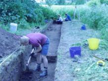
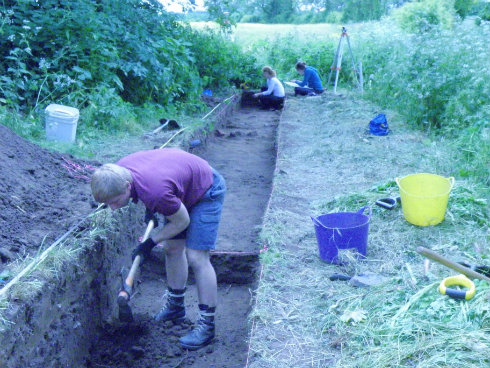
Excavations in July 2013
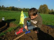
We excavated eight small trenches to examine a range of potentially early features.
Three targeted earthworks which might represent the limits of prehistoric or Roman ploughing around Low Moor. None recovered conclusive dating evidence, but we have taken soil samples for further analysis. By contrast, a trench partly intended to investigate a medieval 'strip field' on the University campus revealed a Roman ground surface buried beneath the ploughsoil.
A trench across the last surviving fragment of a supposed Iron Age boundary called Green Dykes revealed a broad, deep ditch, whose later silts contained 16th-century pottery. We stopped digging because the ditch was unexpectedly deep, but hope to return next year.
Although our geophysical surveys of the Anglo-Saxon cemetery detected numerous possible burials, our two trenches were sited to examine possible structures, avoiding the burials. One proved to be a natural feature, the other a wall, probably of Roman date, much damaged by later ploughing.
Finally, we excavated a trench across a livestock pond, perhaps of medieval origin, which was filled in during the 1980s. Beneath a metre of rubble and old bikes, a rich, organic mud is preserved – once the bottom of the pond. Our findings will help City of York Council to reinstate the pond.
Forthcoming events
Forthcoming events
Extending the earthwork and geophysical surveys
The ridge overlooking the common must have seen prehistoric and Roman activity. But where, what and when? By gradually mapping the extent of medieval ploughing and using geophysical surveys to look beneath this, we hope to find out.
Investigating Siward's Howe
Siward's Howe is a mound on the natural ridge overlooking the University campus. Like Lamel Hill, it was used as a windmill mound, but, here too, its origins may be much earlier. In 2014, we aim to complete geophysical and earthwork surveys of the mound and its environs.
Excavations in July 2014
One of the aims of the 'broad-spectrum' excavation strategy of 2013 was to refine the future direction of the project. Even before post-excavation analysis is complete, future objectives are becoming clear. Join us and find out!
Project Directors:
- Al Oswald
- David Roberts
- Helen Goodchild
Contact: