 Discoveries
So Far
Discoveries
So Far
Sector 1
Sector 1 refers to the Gordon's field through which sweeps the southern arc of a ditch defining an enclosure visible on a 1984 air photograph taken by Prof. Barri Jones.
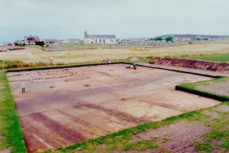
Gordon's field in Sector 1.
This enclosure, one of the reasons for thinking that we are indeed in the presence of a Pictish monastic establishment, forms a D-shape around the knoll of Tarbat Old Church and encloses a valley in which the Sector 2 workshops and mill have been encountered.
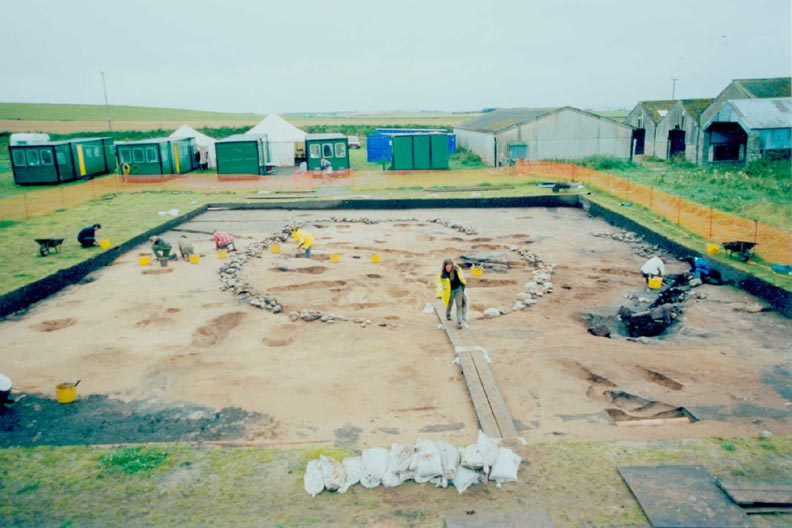
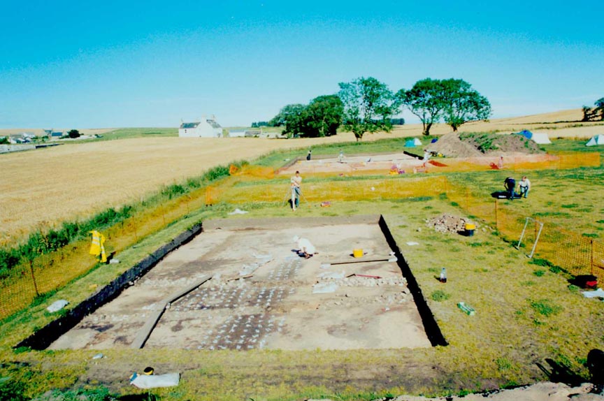
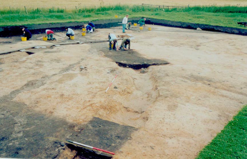
Sector 1 has been mapped in its entirety between 1994 and 2000, using a "strip and map" approach. This procedure identifies all archaeological features visible beneath the ploughsoil without requiring their excavation. A total of 4608 m2, in an area 140 m x 32 m was thus mapped. From 2000 onwards, target areas or selected features in Sector 1 have been excavated.
Some 700 features have been identified to date, forming a palimpsest of shapes cut into the subsoil. Many are difficult to interpret but a number of structures can be readily identified.

Click to view larger images of structure 1.
In particular, a splendid building (Structure 1) whose complete excavation is revealing hitherto unsuspected levels of sophistication: this bag-shaped structure consists of a foundation trench c. 14m x 10m, oriented east-west, with an oval east-end and a rectangular west-end. It is entered by a porch on the north side held by pairs of solid double posts. The eastern part of the building's superstructure is built of an axial arrangement of eight double posts around a central hearth. These double posts each consist of an inner upright post set on pad stones and secured with packing stones, braced by an outer angled bracing post.
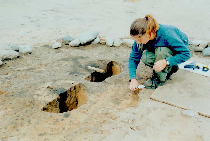
Click to view larger images of postholes.
The western part of the building follows a symmetrical arrangement of pairs of opposing posts. Preliminary analysis by Cecily Spall reveals that some of the posts had been carefully replaced and that the stones used as pad stones originate from the same block of sandstone, cut to shape. Clearly a high level of planning and execution in the building of Structure 1 was intended. Interpretations of the function of this building will depend on the result of the analysis of the assemblage associated with the building and a search for parallels in the Scottish and Irish archaeological records. Interpretations as widely differing as a magna domus (as proposed for a similar building at Iona), a kiln- barn, a smithy and workshop have been put forward. The smithy hypothesis rests on the preliminary observation that hammerscale fragments have been recovered from the central hearth and that a straight- sided, stone-capped feature in the east end of the building may be a flue. Structure 1 belongs to Phase 3 of Tarbat's monastery, provisionally dated to c. 780-1000 AD.
Structure 1 does not sit in splendid isolation: it is flanked by a similar structure (Structure 3) which overlies the "inner enclosure ditch", as does a large, deep, stone-filled excavation whose dissection in 2003 will confirm or infirm the hypothesis that it represents a souterrain.
Click to view larger image of 'souterrain'.
Much of the mapping and selective excavation of Sector 1 is concerned with understanding the course and sequence of the elements that make up the enclosure boundary, perhaps the monastic vallum. It seems that the enclosure started with an "inner enclosure ditch", which appears to have been backfilled before glass and metal working debris of Phase 2 of the monastery (dated to c. 700-780 AD) accumulated in its uppermost fill. It may therefore be suggested that the earliest enclosure dates to Phase 1 of the monastic establishment, starting perhaps in the 6th century and in use in the 7th century.
Click to view larger image of metal and glass working deposits.
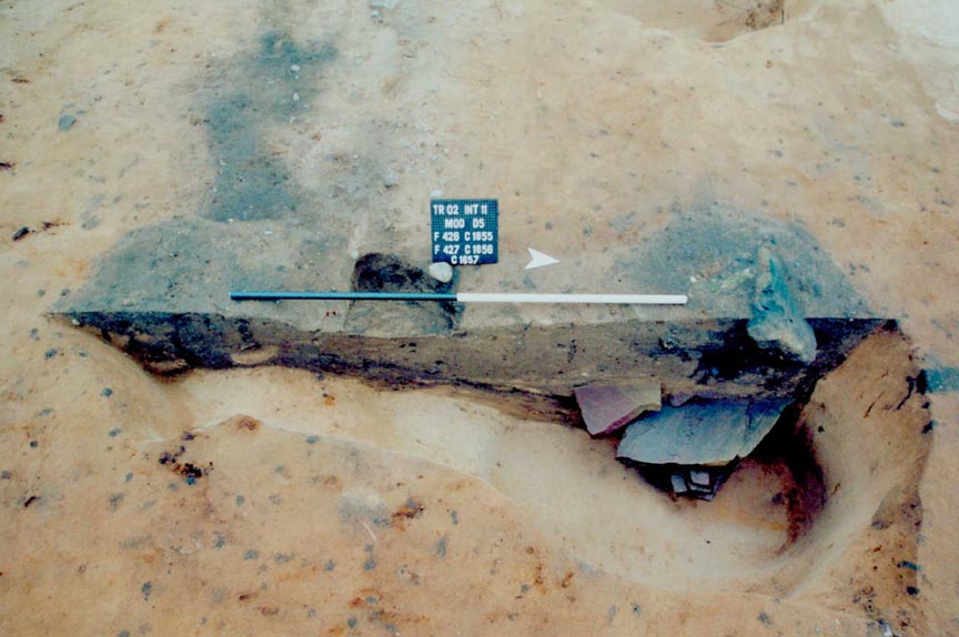
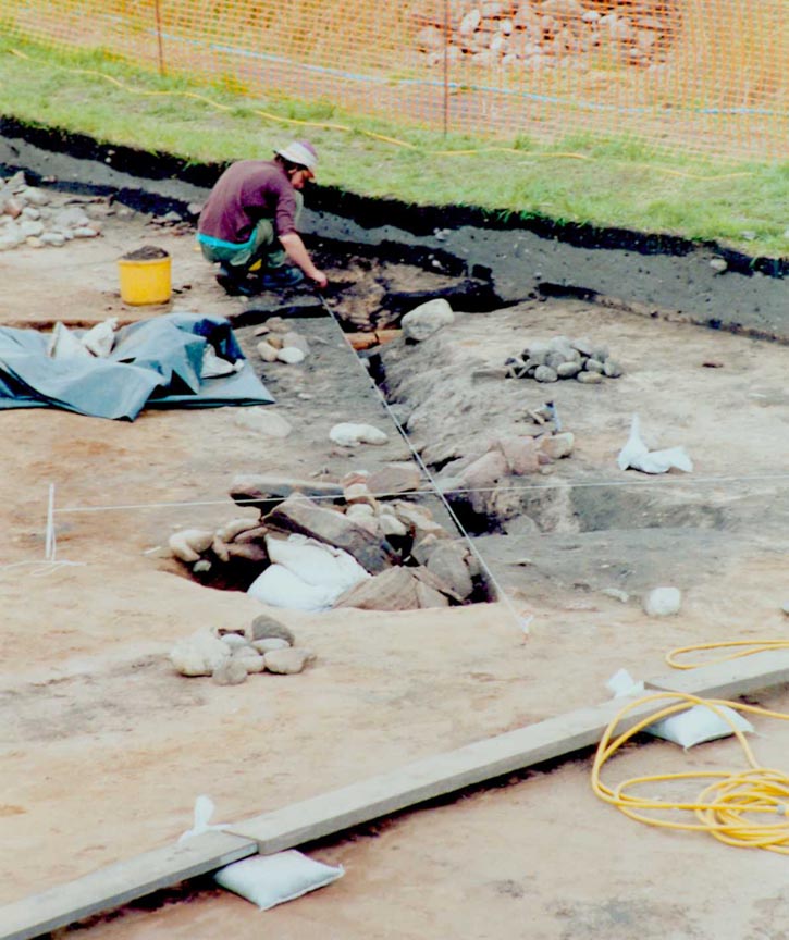
An "outer enclosure ditch" - a misnomer as a multivallate enclosure is not proposed - supercedes this first enclosure, perhaps in the 8th century AD. Circumscribing a slightly enlarged area, but following the same course and enclosing Structures 1, 2 ,3 and 6, this ditch is substantial, some 5-6m wide and surviving to a depth of over 1.5 metres in the subsoil.
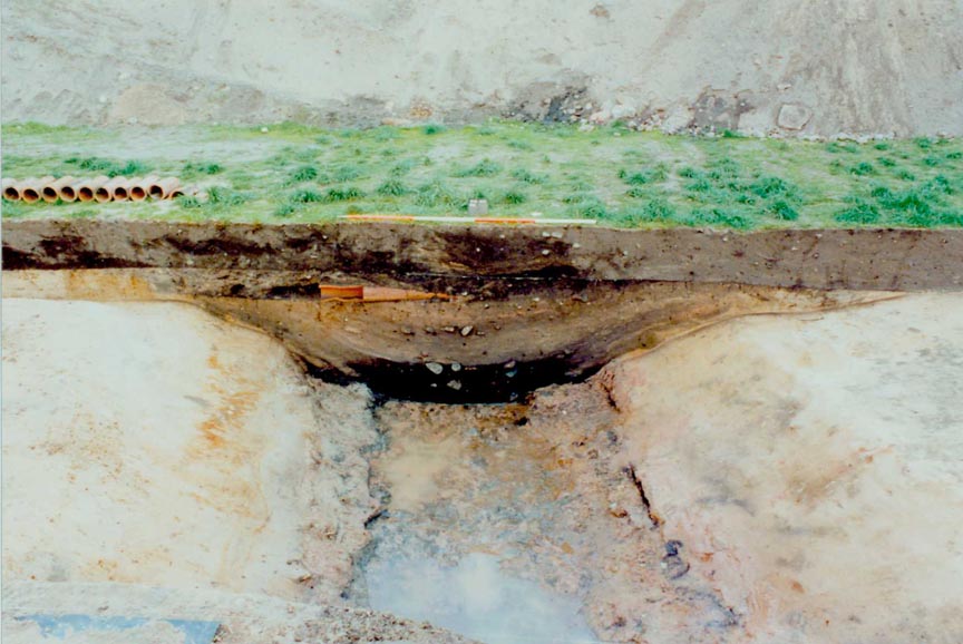
Click to view larger image of ditch in section.
A number of ribbon-like features on its immediate north (i.e. the inside of the enclosure) hint at the presence of footings for a putative inner bank. Though referred to as a vallum, it may be that the primary function of this ditch was as much to mark the boundaries of the monastic establishment, as to act as a storm drain. Drainage appears to have been a major factor in the planning of the monastery, channelling water into a valley in which a mill pond, dam and mill were constructed. It seems also likely that the semicircular ditch that blocks a (yet unproved) entrance into the enclosure at its easternmost end acted as a storm drain to divert water from a clogged-up outer enclosure ditch into the valley to the north.
Click to view larger image of putative entrance way area under excavation.
The dating proposed for the outer enclosure ditch is as follows: despite very early C14 dates (ranging from the 2nd to the 6th century AD) obtained by Jill Harden's evaluation trench in 1991 the radiocarbon date given by a stake driven into the edge of the outer enclosure ditch implies that it was in use soon after the beginning of the 8th century. It stood open for some years before it was re-filled with tree-stumps and branches, in a clearing operation which may prove to be quite late in the history of the site, perhaps the Middle Ages. Later ridge and furrow cultivation overran the filled-in former boundary.
Sector 1 seems to prove that the enclosure was planned and used during the life of the monastic establishment in its first three phases, between the late 6th and 10th centuries AD. All features mapped in Sector 1 appear to respect the enclosure, with the exception of the extreme south-east: there, a series of very tenuous circular or oblong gullies may represent the ephemeral remains of an agricultural exploitation. Amongst them, dating of a structure which may be a corn-drier will help to establish whether features of extra muros farming contemporary with the monastery can be apprehended in Sector 1.
Last updated 10 October, 2003.
Contact the Tarbat Discovery Programme


© 2003-2006 University of York
![]()
![]()
![]()