Department of Archaeology
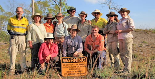
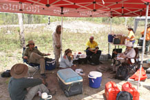
2011 Field Team. Front: Trish Fanning, Simon Holdaway, Justin Shiner. Back: Geoff Bailey, Fiona Petchy, Shezani Nazordeen, Casey Beresford, Tim Mackrell, Annelies Koopman, Craig Sloss, Bernie Larsen, Eloise Hoffman
Enhancing Cultural Heritage Management for Mining Operations
Overview
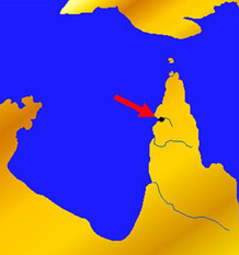
The Weipa region of NW Queensland combines one of the world’s largest open-cast bauxite mines, owned by Rio Tinto Alcan (RTA), with an archaeological record comprising one of the world’s largest intact concentrations of estuarine shell mounds. Bauxite was discovered in 1955, and mining began in the early 1960s. Archaeological exploration soon followed in 1963.
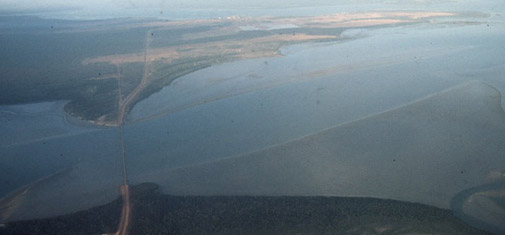
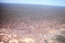
Mission River looking south to bauxite mining on the Weipa Peninsula
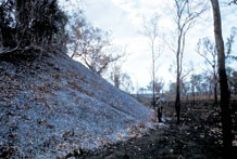
At least 500 shell mounds occur along the four main rivers that flow into Albatross Bay, the largest over 10 m in height. Successive explorations have taken place over the past five decades by Richard Wright, Geoff Bailey, John Beaton, John Chappell, Roger Cribb, Tim Stone, Mick Morrisson and Justin Shiner. Much of the earlier work focussed on the controversy over whether the shell mounds are natural or cultural deposits, and more generally on the processes of shell-mound formation and their relationship to the long-term social and ecological history of the Indigenous Aboriginal communities of the region.
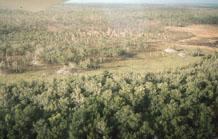
This juxtaposition of modern and ancient land-use practices poses interesting challenges for the investigation of landscape history and the future management of cultural heritage. The present project explores this relationship and capitalises on developments that have taken place over the past decade. These include the empowerment of the local Aboriginal community as Traditional Owners following the introduction of Federal legislation on native title in 1993, and in 2001 a comprehensive Indigenous Land Use Agreement in the western Cape, the appointment of an archaeologist by RTA in 2003 to develop a heritage management strategy, and the introduction of new digital and scientific techniques of archaeological investigation .
Project Aims:
- Use the archaeological record to explore the relationship between variable patterns of human land use over the past six millennia and environmental change in an ecologically rich, geomorphologically dynamic, and climatically fluctuating environment.
- Improve the understanding and management of the cultural heritage through joint involvement of the Aboriginal Traditional Owners, RTA and a wider public.
Project Objectives:
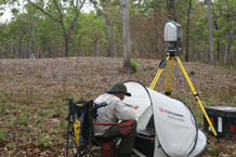
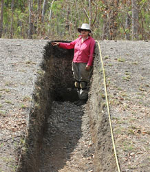
- Survey and excavate shell mounds and associated archaeological deposits such as earth mounds, using GPS and laser technology.
- Map the geomorphological evolution of shorelines, using augering, coring and digital imagery.
- Date mounds, land surfaces and other geomorphological features, using radiocarbon, optically stimulated luminescence, and amino acid racemisation techniques.
- Analyse palaeoenvironmental and palaeoclimatic records, using studies of sediments, plant macro- and micro-fossils, biomolecular markers and stable isotope analyses of shell.
- Integrate the analysis of the coastal archaeological and geomorphological record with stone-tool scatters and other archaeological and geomorphological features in the hinterland.
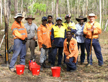
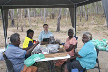
- Engage the Traditional Owners in field investigation, post-excavation analysis and recording of oral histories.
- Compare methods and results with investigations of similar concentrations of shell mounds in other parts of the world such as the Farasan Island study of the DISPERSE project
The 2011 field season has been devoted to the detailed mapping, measurement and sampling of a cluster of over 20 mounds at Wathayn on the north bank of the Embley River with a team of students from the University of Auckland (NZ) and the Free University Amsterdam (Netherlands), the cultural heritage staff of RTA, and Traditional Owners from the Napranum community.
Members
Project Members:
- Patricia Fanning, Macquarie University (AUS), Chief Investigator and Project Leader, Geomorphologist
- Simon Holdaway, University of Auckland (NZ), Partner Investigator, Archaeologist
- Justin Shiner, RTA Weipa (AUS), Partner Investigator, Archaeologist
- Craig Sloss, Queensland University of Technology (AUS), Chief Investigator, Coastal geoscientist
- Sally Brockwell, Australian National University (AUS), Chief Investigator, Archaeologist
- Janelle Stevenson, Chief Investigator, Australian National University (AUS), Palaeoecologist
- Fiona Petchey, Partner Investigator, Waikato University (NZ), Radiocarbon dating specialist
- Geoff Bailey, Partner Investigator, University of York (UK), Archaeologist
Contact Details
Patricia Fanning Graduate School of the Environment, Macquarie University patricia.fanning@mq.edu.au
Simon Holdaway Department of Anthropology, University of Auckland
sj.holdaway@auckland.ac.nz