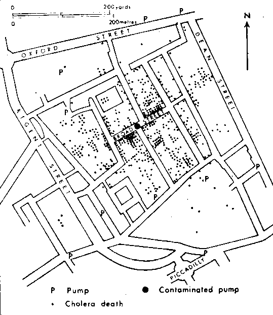
A contaminated water pump in Broad Street proved to be the source for the spread of cholera (Drawn by Dr John Snow about 1854; shown in Stamp, L. D. 1964, A Geography of Life and Death.). This redrafting leaves out some interesting bits of evidence that appeared on the original map, and in Tufte's version. For instance, there was a building across the street from the pump that had no deaths at all.