 Bulletin
6, 2000
Bulletin
6, 2000
Excavation, 2000
The excavation area opened in 2000 comprised the whole of Sector 2 and a sizeable piece of Sector 1- it was the largest that we have had open at one time.
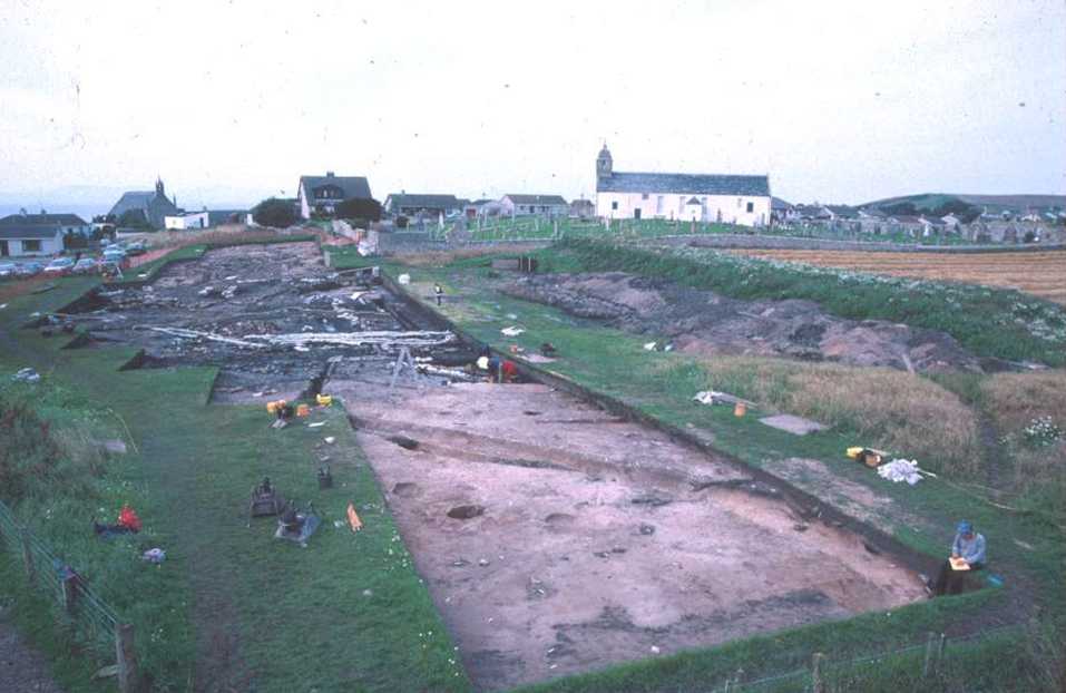
Fig 1: Excavations in the Glebe field beside St Colman's Church in 2000
The season lasted 12 weeks during which the following tasks were completed: Horizon mapping of the south end of Sector 2 and the last part of Sector 1. The whole of the 1 hectare sample has now been mapped.
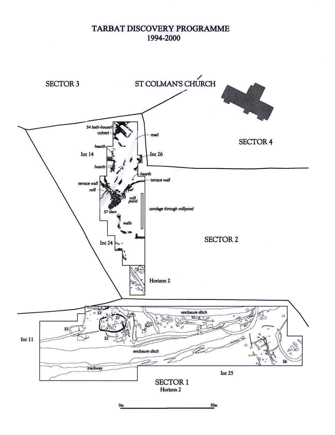 Fig 2 :Map of excavations
to september 2000
Fig 2 :Map of excavations
to september 2000
Further excavation of S4, the so-called bath-house. The building is approximately rectangular with walls of unshaped stone. Part of the interior and some exterior surfaces are reinforced with rammed pebbles. A deep drain runs inside and parallel to the building with a covered culvert providing an outflow.
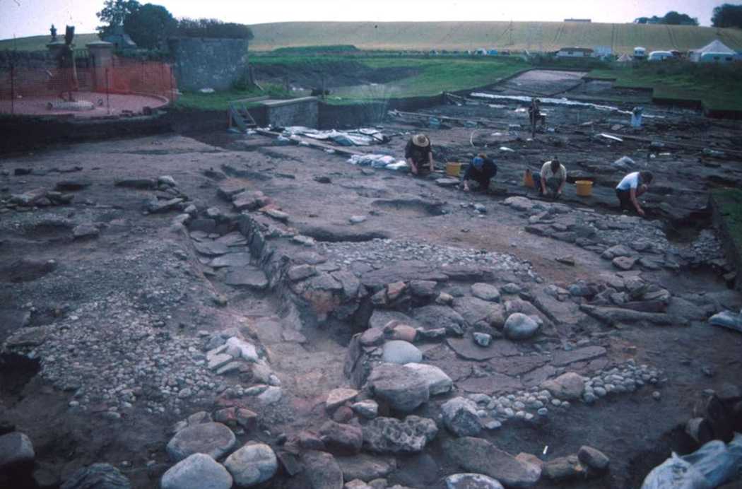
Fig 3: The partially excavated bath-house at the northern end of Sector 2
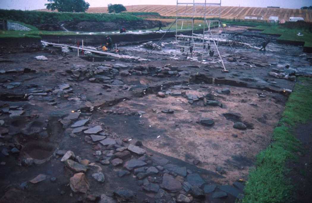
Fig 4: Further excavation of the workshop area
The workshops have some ephemeral walls and stone lined hearths and are identified mainly through a rich harvest of finds relating to working metal, leather, wood and glass. Particularly puzzling were the rows of bones (cattle metapodials) stuck upright in the earth. The rows are about 1-2m long and sometimes join each other at an obtuse angle; but do not border or enclose anything. We have no explanation as yet for these " bone-rows ".
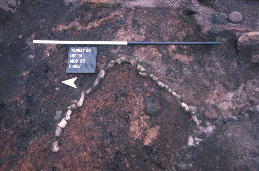
Fig 5: " bone-rows " in the workshop area, Sector 2
South of the workshops an area of peat contained by a megalithic terrace wall was interpeted as a dam creating a mill pond. The character of the mill pond deposit was evaluated witha long N-S trench and found to be about 1.5m deep at the centre. The dam was interuppted by a culvert which may have formed a mill chute. On the west side of the dam an area of water-flow had preserved thin withies possibly from a basket or a fish trap. The mill itself remained elusive but is expected to have a horizontal wheel.
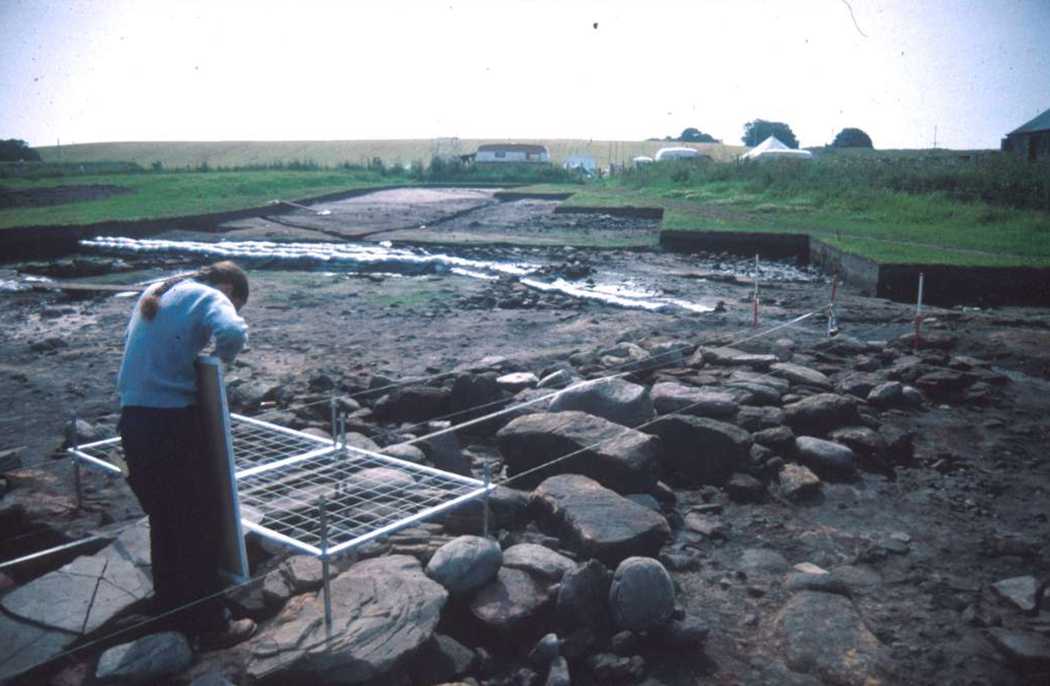
Fig 6: The dam to the mill pond, Sector 2
On Sector 1, the map at horizon 2 of large numbers of features cut into subsoil was completed. An inner enclosure ditch had been backfilled and possibly replaced by an outer enclosure ditch. Adjacent to the inner enclosure ditch were remains from 9th-10th century glass-working which had found their way into its upper fills. The outer enclosure ditch was excvated to the bottom, giving a repeat of earlier profiles. It had silted up and then been rapidly backfilled after an episode of land-clearance which included brushwood and grubbed out tree stumps.
NEXT: Analysis
BACK: Introduction
Last updated 10 October, 2003.
Contact the Tarbat Discovery Programme


© 2003-2006 University of York
![]()
![]()
![]()