 Bulletin
5, 1999
Bulletin
5, 1999
Excavation, 1999
The 1999 season ran from June 13 to August 29 and applied some 1752 person-days to excavation. The Field School ran from 5 July to 15 August and initiated 20 students from 5 countries into the mysteries of excavation. Among these was Heather Strickland, a student from St Andrews Presbytarian College in the USA, who was sponsored by the Meftah Foundation.
There were two areas under investigation in 1999: at the north end of Sector 2 (Int 14, supervised by Stephen Timms, "A" on the map) and at the east end of Sector 1 (Int 25, supervised by Annette Roe, "F" on map)
In Sector 2 ("A"), traces of rectangular stone buildings were found to have burnt down in association with over 100 pieces of Pictish sculpture dating to the 8th century AD. Cut through the debris of this early settlement were some 130 post- and stake-holes. Other than sculpture, the finds associated with the buildings include stone roof tiles, reticella glass, a Frisian sceatta of the early 8th century, a copper alloy boss with silver-gilt spiral decoration, and a bag-shaped crucible and two-piece mould for making bronze objects.
In Sector 1 ("F"), an area of 896 sq metres was mapped, revealing two parallel ditches belonging to the main enclosure and an entrance at its south-east corner. Ard marks showed that the area was intensively cultivated before the enclosure ditches were cut, but there was no prehistoric pottery or other prehistoric artefacts.
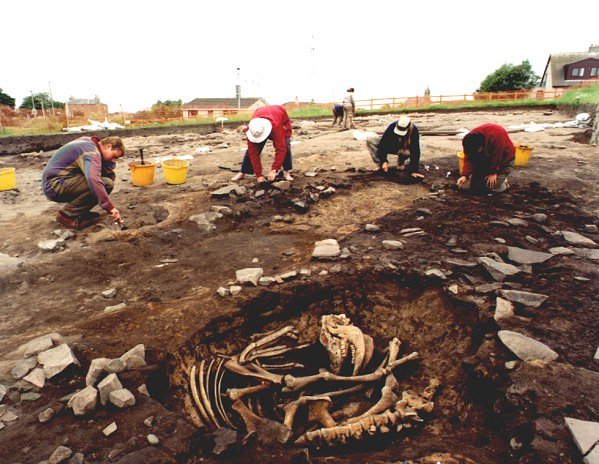
Excavations in progress in the Glebe Field Site (Sector 2). A medieval pit
containing a cow has been cut through the layer of burning and broken sculpture
which marks the end of the Pictish monastery [N235/9]
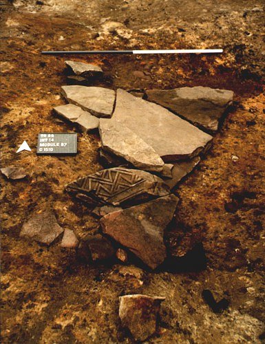
A piece of early medieval carved stone with key pattern in relief, reused
with other slabs as paving. [N241/04]
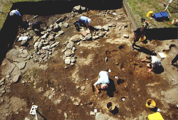
In the central part of Sector 2 excavators define some of the numerous post-holes
cut through the demolished monastic structures. The large slabs and lines
of stones form foundations and revetments thought to belong to a water-mill
[N222/37].
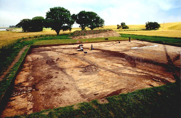
The eastern end of Sector 1 being mapped. An inner ditch (left) runs parallel
to the outer ditch (right) which has already yielded radiocarbon dates in
2-6th century AD. The ditches cut across an earlier agricultural system which
used ards. In the background recorders work over the entrance at the corner
of the enclosure which was later blocked with a crescent shaped ditch. [N221/17]
NEXT: Interpretation
BACK: Credits
Last updated 10 October, 2003.
Contact the Tarbat Discovery Programme


© 2003-2006 University of York
![]()
![]()
![]()